|
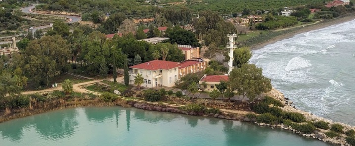
Institute of Marine Sciences
|
|
|
Type of Research Institution
|
| | Intergovernmental | |  | Academic | | | Governmental, national | | | Private | | | Governmental, local | | | Charity / Foundation |
|
|
|
Address : Middle East Technical University
P. O. Box 28 - Ycel
33731 Erdemli
TURKEY |
|
Phone :
+90-324 521 3434
|
|
|
|
Director :
Prof Barış Salihoğlu
|
|
Contact person :
|
|
|
|
|
Number of permanent staff
|
| | Scientists (with doctorate/ PhD) : 20 | | | others : 80 |
|
|
|
Type of Activities
|
| | Pure research | | | Academic | | | Applied research | | | Education / Outreach | | | Long-term monitoring | | | Policy / Planning / Consultancy | | | Technology for environmental applications | | | Conservation & Protection |
|
|
|
Main fields of research (at present - 6 max)
|
| oceanography, sustainable blue economy, climate change & sustainable development, living resources (e.g. fisheries, aquaculture), biodiversity & ecosystems services, management and conservation (incl. biological indicators of GES, MPAs) |
|
|
|
Main research collaborations at international level (at present)
|
|
|
|
|
Ongoing long-term monitoring programs
|
|
|
|
|
Total area dedicated to research (m2)
|
|
|
|
|
Conference room
|
| no | | yes (number of seats : 50 ) |
|
|
|
Research vessel(s)
|
| less than 12 m in length; number of vessels : 0 | | more than 12 m in length; number of vessels : 3 | | Brief description of vessels and on board scientific equipment :
* R/V 'Bilim': the Institute's main research ship, designed as an oceanographic vessel and was launched in 1983 ; steel hull, length : 40.36 m ; beam : 9.47 m ; tonnage : 433 gross, 190 net tons ; draft : 3.80 m ; speed : 11.5 knots max., 9.5 knots cruising, 1.0 knot min ; range : 6500 miles ; propulsion : MWM diesel, 820 HP, variable-pitch propeller, schafran bridge control unit, fuel capacity 120 m3 ; GPS is used for navigation ; the vessel also has conventional radars with 60 and 30 miles range ; the ship has central air conditioning and heating ; the R/V 'Bilim' has quarters for a crew of 12, and can support a scientific party of 14 for a period of about 45 days at sea ; the vessel is fully equiped for stock assessment studies ;
* R/V 'Lamas' : trawler, used in biological and fisheries surveys, built in 1981; gross tons : 28 ; net tons : 7.65 ; 10 knots max speed ; length : 16 m ; crew : 4 ; scientists : 4 ;
* R/V 'Erdemli' : used extensively for coastal oceanographic research ; wooden hull, built in 1979 ; length : 17 m ; crew : 4 ; scientists : 5
|
|
|
|
Other major research facilities and equipment
|
* Field equipment:
*
SeaExplorer Glider, ScanFish, Multi corer, CTD+Rosette System, Argo Profiling Floats, Buoy Systems, Seafloor sampling (Dietz-La Fonde grab, Van Veen grab), Gravity Corer, Partical Size Analyzer, Automatic weather station (Aanderaa and Davis Instruments Weather Monitor II), Andersen dry-wet deposition sampler, Acoustic Doppler current profiler, Fisheries echo sounder, side scan sonar, hydraulic control fish nets, plankton nets.
*
Laboratory equipment:
*
Inductively Coupled Plasma Mass Spectrometer, Ion Chromatography, High Performance Liquid Chromatography, Automatic Winkler Titration System, Real Time Thermal Cycler (PCR machine), Compact Thermal Cycler, Gel Imaging System, Flowcytometer, Spectrophotometers, Spectrofluorometer, Gas chromatography, Elemental Analyzer, Carbon analyzer, C-14 measuring system, Spectroradiometer, Microscopes, dryers, vacuum pumps, benthos mini-rover MK II, four channels autoanalyzer, uniboom, diving equipment, etc.
*
Data processing and computing unit/Satellite image acquisition and processing unit:
*
The capabilities of the satellite image acquisition and processing center of the institute improved significantly through acquisition of real time HRPT/AVHRR pictures from NOAA : the system is capable of receiving data from an area extending from the Arabian to the Baltic Sea and the Atlantic Ocean to the east of the Caspian Sea on a daily basis. The system is also capable of producing sea surface temperature charts. The Institute is also one of the authorized centers to receive Sea WIFS data of the SEASTAR satellite. The remote sensing laboratories of the institute are equipped with a UNIX based work station and various Pentium, 486 and 386 computers operating under LAN.
*
Processing systems:
*
mapiX Ocean AVHRR processing system ; SEAPAK satellite image processing system for analyses of acquired high resolution AVHRR (TIROS-N) and past CZCS (Nimbus-7) images.
|
|
|
|
Ecosystem types available nearby
|
| Direct access to sea | | Direct access to brackish / estuarine waters | |
Other ecosystems : marine ecosystem (coastal zone, pelagic environment, benthic environment), estuaries, lagoons
|
|
|
|
Areas of taxonomic expertise
|
|
|
|
|
Specimen collections
|
| yes | | no |
|
|
|
Hosting facilities for visiting scientists
|
| yes | | no |
|
|
|
Training courses
|
| yes | | no | |
workshops |
|
|
|
Capacity and brief description of library
|
The library’s current collection of approx. 3500 publications covers in the following fields: Physical oceanography, Chemical oceanography, Marine pollution, Marine biology, Marine ecology, Marine geology and geophysics, Fisheries, Ichthyology, and Limnology, Marine Microbiology, Zoology, Toxicology, Law of the Sea, Maritime History, Marine Transport, Fundamental Sciences, Engineering. The METU-IMS library also subscribes to a number of national and international journals dealing with these topics. The Institute library has specialized holdings of books, periodicals, institute's technical reports, regional maps, and reprints pertaining to marine sciences.
Books: 2900; Current journals subscription: 32; total bounded journals: 2500; reports of the Institute: 260; total number of serials: 2500; reprints: 7700.
|
|
|
 CIESM GUIDE OF COASTAL INSTITUTES IN THE MEDITERRANEAN AND ADJACENT SEAS CIESM GUIDE OF COASTAL INSTITUTES IN THE MEDITERRANEAN AND ADJACENT SEAS
Last update : 23/03/2023
|